
TL;DR
The Hatfield-McCoy Trails are a 1,000+ mile network of connected OHV trail systems across southern West Virginia, rated Green (easiest) to Black (most difficult). Little Coal River is the easiest system; Rockhouse, Buffalo Mountain and Bearwallow hold the hardest black-rated terrain. A paid trail permit is required.
Recommended
Recommended for this trail
Affiliate disclosure: As an Amazon Associate, we earn from qualifying purchases, at no extra cost to you. We research rather than test, and commissions never change our rankings. This site is reader-supported: those commissions pay for hosting, research and keeping every guide up to date, so if a guide helped you, buying through our links is an easy way to support it. How we rank · Full disclosure

Best for getting unstuck from sand, mud or snow without another vehicle.
- Nylon recovery boards that give spinning tires grip in sand, mud or snow.
- Double as a shovel to clear sand from in front of the tires.

Best for a complete strap, shackle and glove kit in one bag.
- Straps, shackles, gloves, damper and a recovery bag in one kit.
- Covers most vehicle-to-vehicle recoveries without buying parts separately.
Quick answers
- Need a 4WD, or will AWD/2WD do?
- Yes — 4WD with low range is what the research basis for this place calls for (registered/permitted OHV; DOT or Snell helmet and eye protection required for all riders; trail-appropriate vehicle for black-rated technical sections).
- Trailers/RVs OK?
- Not confirmed — check with Hatfield-McCoy Regional Recreation Authority before you go.
- Dogs allowed?
- Not confirmed — check with Hatfield-McCoy Regional Recreation Authority before you go.
- Campfires allowed?
- Not confirmed — check with Hatfield-McCoy Regional Recreation Authority before you go. Fire restrictions change with drought and season — confirm the current status with Hatfield-McCoy Regional Recreation Authority before you light one.
- Permit or pass needed?
- Required — A trail permit is required for every rider (driver and passengers) (see the official page for current requirements: link below).Official page
- Suggested air-down range?
- Check conditions — no official air-down range is on file for this place; ask at the entrance station or land-manager office.
- Seasonal closures?
- No fixed closure dates on file; see "Best time to go" above (Spring through fall (April-October) for the most reliable trail conditions; check current trail status after heavy rain.).
- Cell coverage?
- Patchy in the more remote, mountainous sections of the trail systems Don’t rely on it — carry a satellite messenger or PLB.
About this place
About Hatfield-McCoy Trails
The Hatfield-McCoy Trail System is one of the largest OHV trail networks in the world, spanning more than 1,000 miles across multiple connected trail systems in southern West Virginia — Rockhouse, Devil Anse and Buffalo Mountain in the southwest, and Pinnacle Creek, Warrior, Indian Ridge, Little Coal River and Pocahontas elsewhere in the network.
Every individual trail carries its own number and difficulty rating — Green for easiest, Blue for more difficult, Black for most difficult — so a single trail system can span wide, graded family-friendly trails alongside genuinely technical, rocky black routes.
Riders typically base themselves at one trailhead within the network and can ride for days without repeating trails, which is part of why it draws multi-day trips from across the country rather than just day visitors.
Why you need 4WD at Hatfield-McCoy Trails
The trail-rating system does most of the explaining: Little Coal River is described as the easiest system in the network, followed by Indian Ridge and Pinnacle Creek, with Bearwallow, Buffalo Mountain and Rockhouse holding the network's toughest terrain.
Reviewers describe black trails at Bearwallow as steep, rocky and genuinely capable of getting a rider stuck for hours, and side-by-side drivers at Rockhouse report being tested by real drop-offs — a step up from the well-maintained, shaded green and blue trails most stock ATVs handle easily.
How hard is it?
Level of difficulty
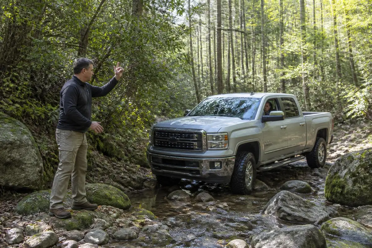
The network's own Green/Blue/Black rating system spans easy to genuinely difficult; Little Coal River is described as the easiest system, while Rockhouse, Buffalo Mountain and Bearwallow's black trails are reported as steep, rocky and technical enough to get riders stuck for hours, which sets the upper end of the score.
Gear this band commonly needs
- 4WD with low range (required)
- A/T or M/T tires, 31"+ recommended
- Rated recovery points front & rear
- Basic recovery kit (strap, shackles)
Hazards flagged for Hatfield-McCoy Trails
- exposure / drop-off
Gear list is our generic trail-rating rubric for this band, not place-specific. Hazards are pulled from this place's own visitor reports and rules, only when explicitly mentioned.
Can My Rig Do It?
Save your rig (tire size & lift height) to see a quick comparison against what Hatfield-McCoy Trails commonly needs.
General guidance only — this compares your saved tire size and lift height against the band's typical gear list, not your actual driving experience, tread pattern, or current trail conditions. It is not a go/no-go decision.
What visitors say
Pros and cons, according to visitors
What visitors love
- Riders describe Rockhouse's dual-track trails as very well maintained, with good views, shade and berms that make even the green trails enjoyable rather than boring source
- Visitors at Bearwallow report the blue and green trails as fun and manageable even for stock ATVs, with a well-equipped trailhead including a visitor station and clean restrooms source
- Multi-day riders report the long drive to reach the trail system is worth it given the sheer scale and variety across the connected trail systems source
What visitors warn about
- Riders report some black trails at Bearwallow are genuinely over their heads, with steep, rocky sections that left them stuck for hours source
- A side-by-side renter at Rockhouse described being tested by drop-offs on the harder trails, cautioning that black-rated terrain is a real step up source
- The network spans multiple separate trail systems across a wide area of southern West Virginia, and reviewers note some planning is needed to figure out which system suits your skill level source
Plan your trip
What it's like in the dry, wet and cold seasons
Dry season
April through October
The main riding season, with the driest and most reliable trail conditions. Trails are open daylight hours only, year-round.
Wet season
year-round, more often in winter/spring
Appalachian rain is common, and trails — especially the black-rated systems — can turn significantly more technical and muddy after wet weather.
Cold season
November-March
Trails stay open, but cold and occasional snow or ice reduce ridership and can make already-technical black trails riskier.
Best time to go
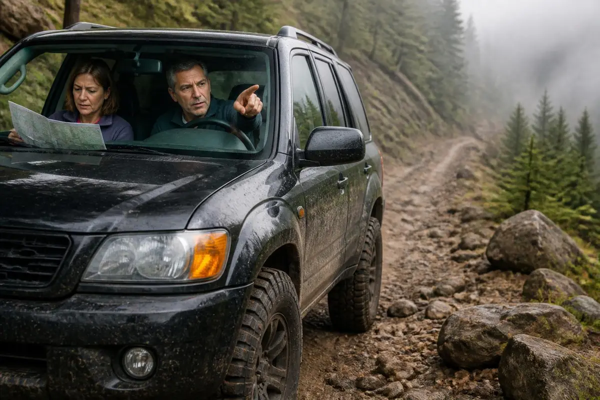
Spring through fall (April-October) for the most reliable trail conditions; check current trail status after heavy rain.
Season & Access
Typical open window
Spring through fall (April-October) for the most reliable trail conditions; check current trail status after heavy rain.
Managing agency
Hatfield-McCoy Regional Recreation Authority
Official map / permit page
Conditions change: confirm with the land manager before you go.
Our recommendations
- Buy your trail permit before arriving, online or at a trailhead
- Start on Green or Blue trails before attempting Black-rated sections
- Pick Little Coal River or Indian Ridge for an easier introduction, and Rockhouse, Bearwallow or Buffalo Mountain for a bigger challenge
- Wear a DOT or Snell-approved helmet and eye protection at all times
- Check trail conditions after heavy rain — black trails get noticeably harder when wet
- Plan which trail system to ride ahead of time; the network spans a wide area of southern West Virginia
- Respect the daylight-hours-only rule and the no-alcohol policy on trail
Amenities
Camping
Numerous private campgrounds and lodges near trailheads across the network; not run directly by the Recreation Authority
Toilets
Available at major trailheads, including Rockhouse and Bearwallow
Drinking water
Available at some trailhead visitor stations
Fuel on site
None on-trail; fuel up in nearby towns before riding
Cell coverage
Patchy in the more remote, mountainous sections of the trail systems
Air-up
Not confirmed — check with the land manager before you go.
Also good to know
The network includes multiple connected trail systems, so riders often base at one trailhead and can ride for days without repeating trails
Recommended
Air down, air up
Affiliate disclosure: As an Amazon Associate, we earn from qualifying purchases, at no extra cost to you. Purchases through these links help keep this site running and up to date. Learn more

Best for fast inflation of larger off-road tires.
- Heavy-duty 12V off-road compressor.
- Built for inflating larger off-road tires quickly.

Best for budget-friendly airing down before sand or rock.
- Adjustable 4-pack of deflators, 10–30 PSI.
- Screw on, set the pressure, and they stop automatically.
Getting there
Where is Hatfield-McCoy Trails?
Topo tiles: USGS The National Map. Fallback layer: © OpenStreetMap contributors.
Rockhouse Trail System trailhead near Man, West Virginia, one of the network's main entry points (37.7495, -81.9345) · Nearest town: Man, WV
How to get there
Each trail system has its own trailhead access, spread across several counties in southern West Virginia — Rockhouse near Man, Bearwallow near Lyburn/Chapmanville, Pinnacle Creek near Justice, and others further out. The Hatfield-McCoy Regional Recreation Authority's Williamson office issues permits and can help direct riders to the right trail system and trailhead for their plans. Permits are also purchasable online and at trailhead kiosks before riding.
Supplies & services
Gas, groceries, mechanics and towing
Nearest shops and gas stations
Gas station
- Speedway3.8 mi
168 Huff Creek Pkwy, Man, WV 25635
Google Maps Apple Maps - C & L Super Serve4.3 mi
720 Huff Creek Pkwy, Mallory, WV 25634
Google Maps Apple Maps - TROGDONS SUPER SERVICE4.3 mi
651 Buffalo Creek Rd, Man, WV 25635
Google Maps Apple Maps
Groceries
- Pic Pac3.6 mi
78 Mountaineer Hwy, Man, WV 25635
Google Maps Apple Maps - GiGi's Grab-N-Go6.2 mi
2004 Jerry W Hwy, Wilkinson, WV 25653
Google Maps Apple Maps - Kroger7.9 mi
25 Holden Rd, Logan, WV 25601
Google Maps Apple Maps
Closest mechanics, towing and tire shops
Mechanic
- Marathon Gas3.4 mi
7716 Jerry W Hwy, Omar, WV 25638
Google Maps Apple Maps - Mac's Service Center4.9 mi
1286 Huff Creek Pkwy, Mallory, WV 25634
Google Maps Apple Maps - Auto Doctor6.3 mi
1936 Jerry W Hwy, Logan, WV 25601
Google Maps Apple Maps
Towing / recovery
- Gaylock Wrecker Service7.8 mi
391 Enterprise Dr, Logan, WV 25601
Google Maps Apple Maps - Premium Towing7.8 mi
501 Riverview Ave, Logan, WV 25601
Google Maps Apple Maps - Hanover Wrecker Services13.5 mi
1776 Interstate Hwy, Hanover, WV 24839
Google Maps Apple Maps
Tire shop
- Jack's Service Center4.7 mi
1147 Buffalo Creek Rd, Kistler, WV 25628
Google Maps Apple Maps - EMS Tire Pros6.4 mi
170 Stollings Ave, Logan, WV 25601
Google Maps Apple Maps - P & A Auto Repair6.9 mi
775 Stratton St, Logan, WV 25601
Google Maps Apple Maps
Distances are straight-line miles from the map pin; the drive is longer. Listings come from Google Maps business data (checked September 2026); emails are shown only where the business publishes one on its own website. Hours change, so call ahead, especially off-season.
Stay safe
Emergency services
In an emergency, call 911 first
Police, fire, ambulance and search & rescue. The contacts below are a courtesy and can change.
Nearest hospital
Logan Regional Medical Center
20 Hospital Dr, Logan, WV 25601
Nearest hospital serving the Rockhouse/Man, WV area of the trail network
Google Maps Apple MapsSheriff
Logan County Sheriff's Office
Covers the Rockhouse trail system area; other trail systems fall under different county sheriffs
Land manager
Hatfield-McCoy Regional Recreation Authority
241 Recreation Dr, Williamson, WV 25661
Manages the full trail network and issues permits
Google Maps Apple MapsBefore you lose signal
Cell coverage is patchy in the more remote, mountainous parts of the network; carry a way to signal for help on longer black-trail rides, and note that different trail systems fall under different county emergency services.
Good to know
Rules and permits
A trail permit is required for every rider, whether driving or riding as a passenger; there's no separate day or weekly pass, and any permit runs from the date of purchase through December 31 of that year. West Virginia residents and active or veteran military pay $26.50; everyone else pays $65, up from $50 after a November 2025 fee adjustment. All riders must wear a DOT or Snell-approved helmet with eye protection, and operators and passengers must meet manufacturer minimum age and size requirements, with no one under 6 allowed on the trails at all. Trails are open daylight hours only, and littering, camping, open fires and alcohol are all prohibited on the trails themselves.
Permit: A trail permit is required for every rider (driver and passengers). There is no separate day or weekly pass: every permit is valid from the date of purchase through December 31 of that year. The WV resident (with a WV driver's license or state ID) and active/veteran military rate is $26.50; the non-resident rate is $65, raised from $50 in a fee adjustment effective November 17, 2025 — the Recreation Authority's first price change in about two decades. (official page)
- A trail permit is required for every rider, driver and passenger alike
- DOT or Snell-approved helmet and eye protection required for all riders
- Operators and passengers must meet manufacturer minimum age/size requirements; no one under 6 allowed on the trails
- Trails open daylight hours only
- No littering, camping, fires or alcohol on the trails themselves
Gear for this trip
A first recovery kit for any 4WD
Affiliate disclosure: As an Amazon Associate, we earn from qualifying purchases, at no extra cost to you. Purchases through these links help keep this site running and up to date. Learn more

Best for airing all four tires down to a set pressure at once.
- Automatic deflators preset between 6 and 30 PSI.
- Air all four tires down at once, then stop at the set pressure.

Best for airing back up before you hit pavement.
- Portable 12V compressor rated to 150 PSI.
- Sized for truck and SUV tires.

Best for plugging a tread puncture on the trail.
- Reamer-and-plugger kit for tread punctures.
- Lets you plug a tire on the trail instead of changing it.
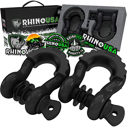
Best for rated connection points for straps and ropes.
- 3/4 in D-ring shackles, 41,850 lb listed break strength (2-pack).
- Connect straps to rated recovery points.
We research products from manufacturer specs and owner feedback; we don't test them ourselves. How we choose.
Straight answers
Hatfield-McCoy Trails FAQ
How much does a Hatfield-McCoy trail permit cost?
A West Virginia resident (or active/veteran military) permit is $26.50; a non-resident permit is $65, up from $50 after a fee adjustment effective November 17, 2025 — the first change to pricing in about two decades. There's no separate day or week rate; every permit is valid from the date of purchase through December 31 of that calendar year, so buying early in the season stretches its value further.
What is the easiest Hatfield-McCoy trail system?
Little Coal River is described as the easiest system in the network, followed by Indian Ridge and Pinnacle Creek, which have the largest share of green-rated, beginner-friendly trails.
What is the hardest Hatfield-McCoy trail system?
Rockhouse, Buffalo Mountain and Bearwallow hold the network's toughest black-rated terrain, with steep, rocky sections that have been reported to challenge even experienced riders.
Do you need a permit for every rider at Hatfield-McCoy?
Yes — a trail permit is required for every driver and passenger, not just one per vehicle.
How many miles of trail does Hatfield-McCoy have?
The connected network spans more than 1,000 miles across multiple trail systems, making it one of the largest OHV trail networks in the world.
Can you camp on the Hatfield-McCoy trails?
No — camping, fires and alcohol are all prohibited directly on the trails, though numerous private campgrounds and lodges near the trailheads accommodate overnight visitors.
Sources
Researched from official land-manager, county and hospital sites plus published visitor reports. We have not driven every trail ourselves. See how we research.
- West Virginia Tourism — Hatfield-McCoy Permit Basics — Permit fee structure (resident/military $26.50, non-resident $65, valid through Dec 31 of purchase year)
- Hatfield-McCoy Trails — 2026 Trail Permit Fee Adjustment announcement — Non-resident fee increase from $50 to $65 effective Nov 17, 2025; first price change in about two decades
- Hatfield-McCoy Trails — Trail Rules & Regulations — Helmet, age, daylight-hours, no-alcohol rules; difficulty rating system
- Hatfield-McCoy Trails — Contact Us — Recreation Authority office address and phone numbers
- Logan County Sheriff's Office — Contact — Sheriff's office phone number
- Logan Regional Medical Center — Contact — Nearest hospital name, address and phone number
- Visitor reports (TripAdvisor, ATV forums), summarized — Pros/cons paraphrased from real visitor and rider reports
Keep exploring