
TL;DR
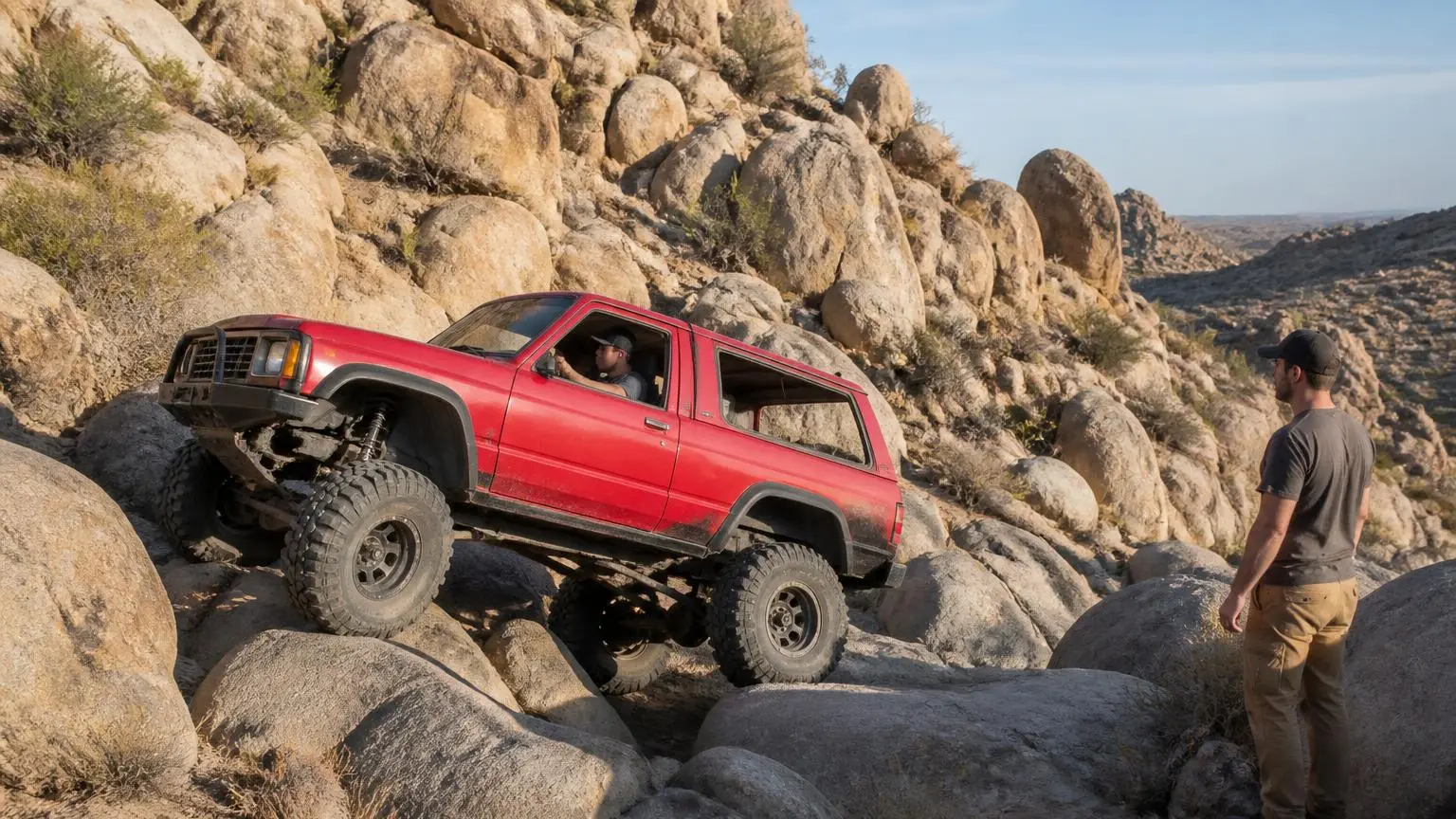
Johnson Valley is a roughly 96,000-acre BLM OHV area in the Mojave Desert, home to the extreme 'Hammers' rock-crawl trails and the King of the Hammers race. Open desert routes suit any high-clearance 4WD; named trails like Jackhammer need a fully built rig.
Recommended
Recommended for this trail
Affiliate disclosure: As an Amazon Associate, we earn from qualifying purchases, at no extra cost to you. We research rather than test, and commissions never change our rankings. This site is reader-supported: those commissions pay for hosting, research and keeping every guide up to date, so if a guide helped you, buying through our links is an easy way to support it. How we rank · Full disclosure

Best for a complete strap, shackle and glove kit in one bag.
- Straps, shackles, gloves, damper and a recovery bag in one kit.
- Covers most vehicle-to-vehicle recoveries without buying parts separately.

Best for vehicle-to-vehicle snatch recoveries.
- 1 in x 30 ft kinetic rope that stretches to ease a stuck vehicle out.
- Gentler on recovery points than a static tow strap.
Quick answers
- Need a 4WD, or will AWD/2WD do?
- Yes — 4WD with low range is what the research basis for this place calls for (built rock rig for the Hammers trails; 37"+ tires, lockers, full armor, winch for the hardest routes; stock high-clearance 4WD is fine for open desert/graded routes).
- Trailers/RVs OK?
- Not confirmed — check with BLM Barstow Field Office, jointly managed with the Marine Corps Air Ground Combat Center Twentynine Palms for a portion of the basin before you go.
- Dogs allowed?
- Not confirmed — check with BLM Barstow Field Office, jointly managed with the Marine Corps Air Ground Combat Center Twentynine Palms for a portion of the basin before you go.
- Campfires allowed?
- Not confirmed — check with BLM Barstow Field Office, jointly managed with the Marine Corps Air Ground Combat Center Twentynine Palms for a portion of the basin before you go. Fire restrictions change with drought and season — confirm the current status with BLM Barstow Field Office, jointly managed with the Marine Corps Air Ground Combat Center Twentynine Palms for a portion of the basin before you light one.
- Permit or pass needed?
- Not required, per the research on file for this place.Official page
- Suggested air-down range?
- Check conditions — no official air-down range is on file for this place; ask at the entrance station or land-manager office.
- Seasonal closures?
- Roughly 81,000 of the area's 96,000 acres close to the public for about 10 days each year for the King of the Hammers race under a BLM Special Recreation Permit; about 46,000 acres remain open during the closure
- Cell coverage?
- Spotty across most of the basin, better near Highway 247 Don’t rely on it — carry a satellite messenger or PLB.
About this place
About Johnson Valley
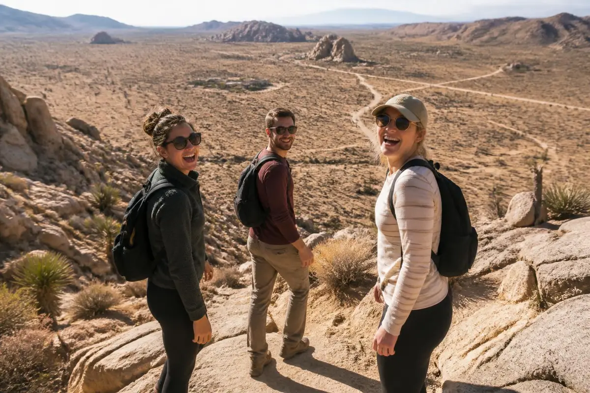
Johnson Valley OHV Recreation Area sits in the Mojave Desert north of Yucca Valley and is the largest dedicated OHV area in California, managed by the BLM Barstow Field Office. It's best known for the Hammers, a network of granite canyons carrying some of the toughest named rock-crawl trails in the country.
Trails inside the Hammers carry their own reputations and names — Backdoor, Chocolate Thunder, Sledgehammer, Wrecking Ball, Outerlimits and Jackhammer among them — and each has developed its own following among rock-crawling owners who travel from across the country to run them.
Outside the Hammers, Johnson Valley is also just a huge stretch of open BLM desert, with graded roads and dispersed camping that suit anything from a stock high-clearance SUV to a dedicated buggy, which is part of why it draws such a mixed crowd of casual desert campers and hardcore rock crawlers.
Why you need 4WD at Johnson Valley
The named Hammers trails are granite canyon routes with obstacles reviewers describe as at the upper end of US rock-crawl difficulty — Jackhammer in particular is widely considered one of the hardest recreational routes anywhere, with near-vertical ledges taller than most vehicles that call for 37-inch-plus tires, lockers, full underbody armor and a winch.
The rest of the valley is far more forgiving; open desert tracks and graded access roads are drivable in a stock high-clearance 4WD, so the vehicle you need really depends on which part of Johnson Valley you're heading into.
How hard is it?
Level of difficulty
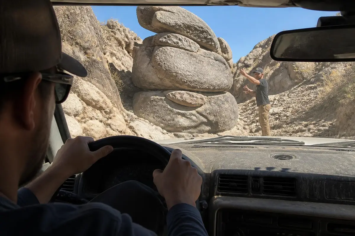
The named Hammers trails (Jackhammer, Sledgehammer, Chocolate Thunder, Backdoor) are described by trail guides as at the upper end of US rock-crawl difficulty, needing a purpose-built rig; open desert areas outside the Hammers are far easier, so the score reflects the area's hardest named trails, not the whole OHV area.
Gear this band commonly needs
- Built rig: lockers front & rear
- 35"+ tires, armor / sliders / bumpers
- Winch (required, not optional)
- Two vehicles / group travel recommended
- Satellite communicator (no cell coverage assumed)
Hazards flagged for Johnson Valley
Not flagged in this place's research — see the pros/cons and rules below for the full detail.
Gear list is our generic trail-rating rubric for this band, not place-specific. Hazards are pulled from this place's own visitor reports and rules, only when explicitly mentioned.
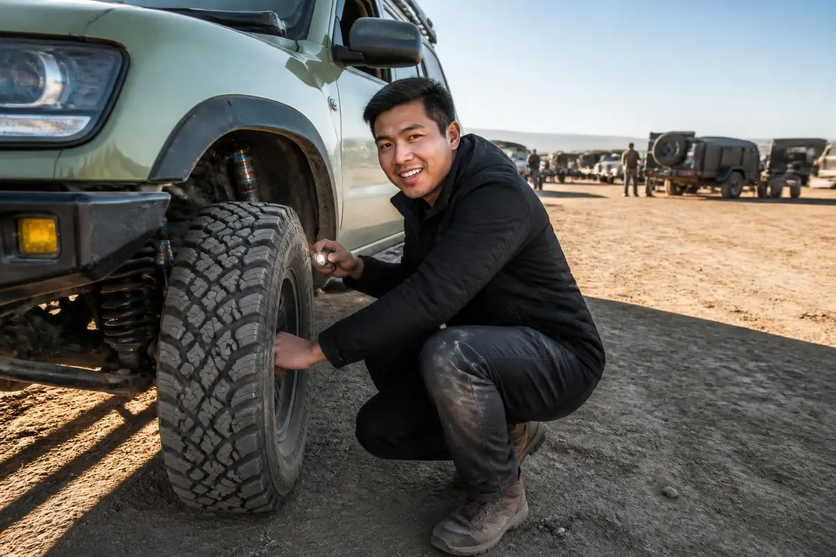
Can My Rig Do It?
Save your rig (tire size & lift height) to see a quick comparison against what Johnson Valley commonly needs.
General guidance only — this compares your saved tire size and lift height against the band's typical gear list, not your actual driving experience, tread pattern, or current trail conditions. It is not a go/no-go decision.
What visitors say
Pros and cons, according to visitors
What visitors love
- Reviewers describe Johnson Valley as offering trails for every skill level, from open desert cruising to the extreme Hammers routes, in one area source
- The Hammers trail network is regarded by off-road owners as a bucket-list rock-crawling destination, with named trails like Jackhammer and Sledgehammer drawing dedicated trail-guide coverage source
- Dispersed camping is free and unrestricted across most of the open BLM land, which owners note makes it an inexpensive multi-day basecamp source
What visitors warn about
- The hardest Hammers trails are reported as genuinely extreme, with obstacles that stop all but the most capable, purpose-built rigs source
- Roughly 81,000 acres close to the public for about 10 days each year during the King of the Hammers event, which catches some visitors by surprise if they don't check dates first source
- Summer heat in this part of the Mojave is reported as dangerous for both vehicles and people, pushing most visits into the cooler months source
Plan your trip
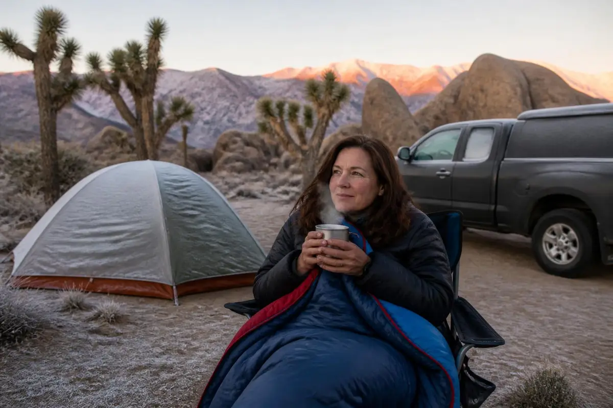
What it's like in the dry, wet and cold seasons
Dry season
October through April
This is the main season for both casual OHV use and for King of the Hammers, typically held in late January or early February. Daytime temperatures are far more manageable than summer.
Wet season
occasional winter storms
Desert rain is infrequent here but can soften washes and the dry lakebed quickly, and flash flooding is a real, if rare, risk when it does rain.
Cold season
December-February nights
Desert nights swing cold even when the daytime is mild, so camping gear needs to cover a big temperature range if you're staying overnight.
Best time to go
October through April, avoiding the extreme summer desert heat; check BLM closure dates before a King of the Hammers-season trip.
Season & Access
Typical open window
October through April, avoiding the extreme summer desert heat; check BLM closure dates before a King of the Hammers-season trip.
Managing agency
BLM Barstow Field Office, jointly managed with the Marine Corps Air Ground Combat Center Twentynine Palms for a portion of the basin
Conditions change: confirm with the land manager before you go.
Our recommendations
- Check BLM's published closure dates before visiting during King of the Hammers season
- Match your rig to the trail — the Hammers need a built vehicle, not a stock 4WD
- Run a winch and full recovery gear on any named Hammers route, with a spotter
- Travel with at least one other vehicle on the harder trails
- Plan trips October through April to avoid dangerous summer desert heat
- Air down for rocky sections and re-air before the highway drive home
- Carry more water and fuel than you think you'll need — services in the basin itself are sparse
Amenities
Camping
Free dispersed BLM camping across most of the open area, standard 14-day stay limit
Toilets
Portable toilets are brought in during King of the Hammers event week; no permanent restrooms in the basin
Drinking water
No potable water in the OHV area itself
Fuel on site
None; nearest fuel is in Landers/Yucca Valley
Cell coverage
Spotty across most of the basin, better near Highway 247
Air-up
Not confirmed — check with the land manager before you go.
Also good to know
Access is mainly via Camp Rock Road or Old Woman Springs Road off Highway 247, about 55 miles southeast of Barstow
Recommended
Air down, air up
Affiliate disclosure: As an Amazon Associate, we earn from qualifying purchases, at no extra cost to you. Purchases through these links help keep this site running and up to date. Learn more

Best for airing all four tires down to a set pressure at once.
- Automatic deflators preset between 6 and 30 PSI.
- Air all four tires down at once, then stop at the set pressure.

Best for airing back up before you hit pavement.
- Portable 12V compressor rated to 150 PSI.
- Sized for truck and SUV tires.
Getting there
Where is Johnson Valley?
Topo tiles: USGS The National Map. Fallback layer: © OpenStreetMap contributors.
Means Dry Lake / Hammertown staging area off Camp Rock Road, the main access point into the Hammers trail network (34.3897, -116.5083) · Nearest town: Landers, CA
How to get there
Most visitors reach Johnson Valley off Highway 247, entering via Camp Rock Road or Old Woman Springs Road, roughly 55 miles southeast of Barstow and about 10 miles from Landers. There's no entrance station or fee gate — it's open BLM land — but a large portion closes to the public for about 10 days each year during King of the Hammers under a BLM Special Recreation Permit, so checking current closure dates before heading out is worth doing every time.
Supplies & services
Gas, groceries, mechanics and towing
Nearest shops and gas stations
Gas station
- Mobil10.5 mi
282 Old Woman Springs Rd, Yucca Valley, CA 92284
Google Maps Apple Maps - Hero11.6 mi
1160 Old Woman Springs Rd, Yucca Valley, CA 92284
Google Maps Apple Maps - Valero11.6 mi
Homestead Valley, CA 92284
Google Maps Apple Maps
Groceries
- Grocery Outlet19.1 mi
57200 29 Palms Hwy, Yucca Valley, CA 92284
Google Maps Apple Maps - Lakeview Market26 mi
40133 Big Bear Blvd Space 420, Big Bear Lake, CA 92315
Google Maps Apple Maps - ampm39.2 mi
2228 W Ramsey St, Banning, CA 92220
Google Maps Apple Maps
Closest mechanics, towing and tire shops
Mechanic
- Shirley reper tires30.2 mi
46525 Magney Ln, Newberry Springs, CA 92365
Google Maps Apple Maps - Action Auto Repair36.2 mi
2461 Hunsaker Dr, Running Springs, CA 92382
Google Maps Apple Maps - Eddie's Auto Care 239.9 mi
34229 Yucaipa Blvd, Yucaipa, CA 92399
Google Maps Apple Maps
Towing / recovery
- Blairs IE heavy medium10.8 mi
890 Landers Ln, Landers, CA 92285
Google Maps Apple Maps - Yucca Valley Towing18.9 mi
55525 Yucca Trail, Yucca Valley, CA 92284
Google Maps Apple Maps - Hills towing19 mi
7343 Fox Trail, Yucca Valley, CA 92284
Google Maps Apple Maps
Tire shop
- Wheel City & Tires29.9 mi
12525 Palm Dr, Desert Hot Springs, CA 92240
Google Maps Apple Maps - Charly's Tires39.5 mi
31562 San Luis Rey Dr, Cathedral City, CA 92234
Google Maps Apple Maps - Hoffmans Motors39.8 mi
650 S Eugene Rd, Palm Springs, CA 92262
Google Maps Apple Maps
Distances are straight-line miles from the map pin; the drive is longer. Listings come from Google Maps business data (checked September 2026); emails are shown only where the business publishes one on its own website. Hours change, so call ahead, especially off-season.
Stay safe
Emergency services
In an emergency, call 911 first
Police, fire, ambulance and search & rescue. The contacts below are a courtesy and can change.
Nearest hospital
Hi-Desert Medical Center
6601 White Feather Rd, Joshua Tree, CA 92252
Nearest hospital, in Joshua Tree
Google Maps Apple MapsSheriff
San Bernardino County Sheriff — Morongo Basin Station
Covers the Johnson Valley/Landers area
Land manager
BLM Barstow Field Office
2601 Barstow Rd, Barstow, CA 92311
Manages the Johnson Valley OHV Recreation Area
Google Maps Apple MapsBefore you lose signal
Cell coverage is spotty through most of the basin; carry a satellite messenger for solo or small-group trips into the Hammers trails, and let someone know your planned route and return time.
Good to know
Rules and permits
OHVs need a California Green Sticker or Red Sticker, or current street registration, to ride in Johnson Valley. Roughly 81,000 of the area's 96,000 acres close to the public for about 10 days a year during King of the Hammers, with about 46,000 acres remaining open during that window. A portion of the basin is shared with the nearby Marine Corps base for periodic military training and can close separately. Camping is free and dispersed under the standard BLM 14-day stay limit, with no developed campgrounds.
Permit: No permit or fee for general OHV use; vehicles need California Green Sticker or Red Sticker OHV registration, or current street registration. A BLM Special Recreation Permit governs the annual King of the Hammers race, which triggers a temporary multi-day closure of roughly 81,000 acres of the area (about 46,000 acres stay open to the public during the event). (official page)
- OHVs need a California Green Sticker or Red Sticker, or current street registration, to ride
- Roughly 81,000 of the area's 96,000 acres close to the public for about 10 days each year for the King of the Hammers race under a BLM Special Recreation Permit; about 46,000 acres remain open during the closure
- A portion of the basin is shared with the Marine Corps Air Ground Combat Center for periodic military training and may close separately
- Standard BLM 14-day camping stay limit applies
- No developed campgrounds — camping is dispersed
Gear for this trip
Gear for rocky, technical trails
Affiliate disclosure: As an Amazon Associate, we earn from qualifying purchases, at no extra cost to you. Purchases through these links help keep this site running and up to date. Learn more
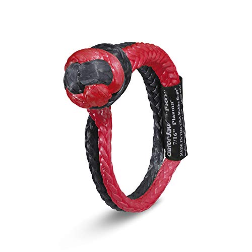
Best for a lighter alternative to steel shackles.
- 7/16 in synthetic soft shackle, 52,300 lb listed breaking strength.
- Lighter than a steel shackle and won't become a projectile.

Best for solo self-recovery on steep or muddy trails.
- 12V winch with a 10,000 lb rated pull.
- Sized for full-size trucks and SUVs.

Best for plugging a tread puncture on the trail.
- Reamer-and-plugger kit for tread punctures.
- Lets you plug a tire on the trail instead of changing it.
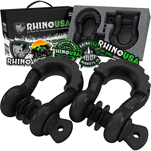
Best for rated connection points for straps and ropes.
- 3/4 in D-ring shackles, 41,850 lb listed break strength (2-pack).
- Connect straps to rated recovery points.
We research products from manufacturer specs and owner feedback; we don't test them ourselves. How we choose.
Straight answers
Johnson Valley FAQ
What is Johnson Valley known for?
Johnson Valley is best known for the Hammers, a network of extreme granite-canyon rock-crawl trails, and for hosting King of the Hammers, a major off-road race held under a BLM Special Recreation Permit each winter.
Is Johnson Valley open to the public year-round?
Most of it is, but roughly 81,000 of its 96,000 acres close to the public for about 10 days a year during King of the Hammers, typically in late January or early February, with about 46,000 acres remaining open during that window.
Do you need a permit to ride in Johnson Valley?
No permit is needed for general OHV use — vehicles just need a California Green Sticker or Red Sticker, or current street registration. The King of the Hammers event itself is authorized under a separate BLM Special Recreation Permit.
What is the hardest trail in Johnson Valley?
Jackhammer is widely considered the toughest named trail in the Hammers network and among the most difficult recreational rock-crawling routes anywhere, with near-vertical ledges that call for a fully built rig with 37-inch-plus tires, lockers and a winch.
Can you camp in Johnson Valley?
Yes — camping is free and dispersed across most of the open BLM land, under the standard 14-day stay limit, with no developed campgrounds or hookups.
What vehicle do you need for Johnson Valley?
It depends where you're going. Open desert tracks and graded roads suit a stock high-clearance 4WD, while the named Hammers trails need a purpose-built rig with lockers, oversized tires, armor and a winch.
Sources
Researched from official land-manager, county and hospital sites plus published visitor reports. We have not driven every trail ourselves. See how we research.
- Bureau of Land Management — Johnson Valley OHV Area — Managing agency, area size, access roads, permit/registration rules
- Bureau of Land Management — press release on King of the Hammers closure — King of the Hammers closure acreage and permit basis
- San Bernardino County Sheriff's Department — Morongo Basin Station — Sheriff station identity and phone number
- Desert Care Network — Hi-Desert Medical Center — Nearest hospital name, address and phone number
- Visitor and trail-guide reports (Ordealist, Truck Brigade, DrivingLine), summarized — Pros/cons paraphrased from real visitor and trail-guide reports
Keep exploring
More 4x4 places
Big Bend Backcountry Roads, Texas
national park primitive 4x4 road network · difficulty 6/10
Coral Pink Sand Dunes, Utah
sand dune OHV area · difficulty 4/10
Death Valley Backcountry Roads, California
national park primitive 4x4 road network · difficulty 5/10
Fish Creek Wash, California
desert wash / badlands 4x4 road · difficulty 3/10
Glamis (Imperial Sand Dunes), California
sand dunes (OHV recreation area) · difficulty 7/10
Hatfield-McCoy Trails, West Virginia
OHV trail network · difficulty 6/10
Mojave Road, California
historic desert 4x4 route · difficulty 5/10
Uwharrie National Forest, North Carolina
national forest OHV trail network · difficulty 6/10